Last updated 7 August 2026. This page was reviewed on that date. Prices, rates and opening hours change often in Singapore — confirm anything that matters directly with the business before you travel or spend.
Quick answer: For a taste of old-school hawker charm in the heart of the CBD, head to Lau Pa Sat. Our picks: Yum Cha Express for steaming dim sum, LiXin Teochew Fishball Noodles for Michelin-recognised springy noodles, Nasi Lemak Ayam Taliwang for Indonesian-inspired nasi lemak, Thunder Tea Rice for a wholesome herbal bowl, Feng Xiang Bak Kut Teh for comforting herbal soup, Lao Fu Zi Fried Kway Teow for wok hei, and Kallang Airport Wanton Noodle for a nostalgic plate. Whether you’re rushing lunch or lingering over supper, there’s a stall here for you.
You want a meal that justifies the trip, not just another plate of rice. This guide is for the lunch-goer who benchmarks every dollar and minute spent. We’ve lined up the stalls where consistency, speed, and honest flavour let you get back to work recharged—no hype, just what actually holds up under a busy schedule.

If none of these quite fit, Best Food in Central Singapore & the City has 70 lists covering the rest of the category.
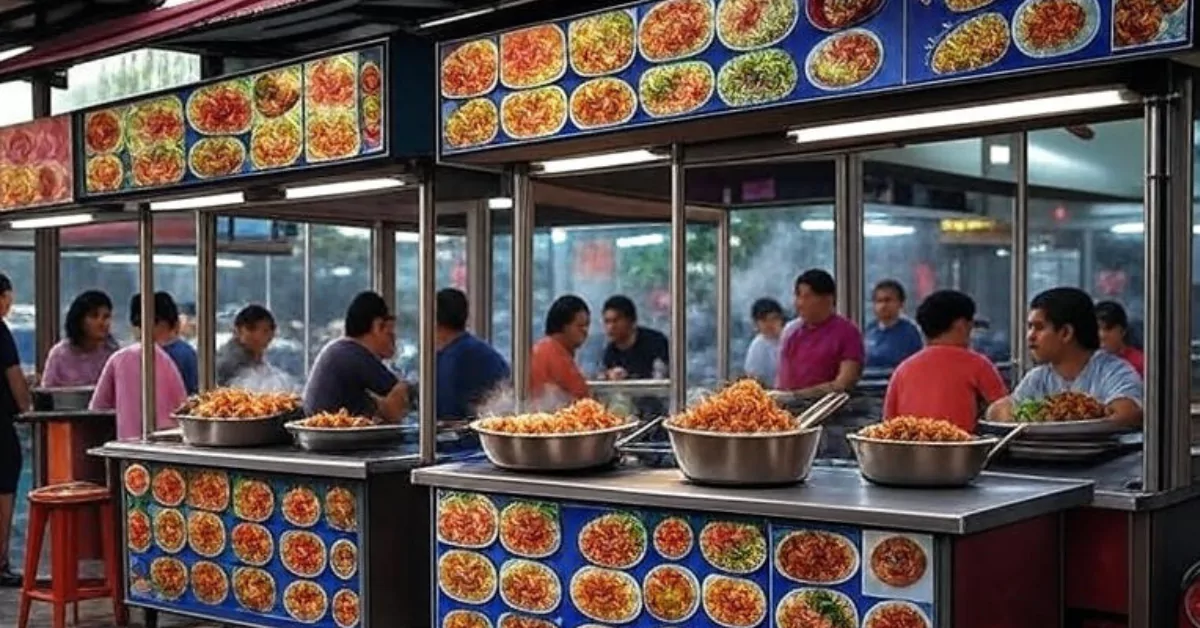
If you’re exploring beyond this historic hawker centre, Food in Katong offers a different rhythm of local eating worth the trip.
Yum Cha Express

Yum Cha Express sits inside Lau Pa Sat, turning out dim sum daily from half ten in the morning till nine at night. The stall works like a condensed tea house: har gow, siew mai, char siew sou, and chee cheong fun all made fresh, with vegetarian options so nobody has to sit out the feast. It lands that sweet spot of restaurant quality at hawker speed, making it a natural choice when a dim sum craving hits mid-week and you just want to eat and go.
This is your efficient dim sum solution when a craving strikes between meetings. The streamlined menu means you order fast, eat in air-conditioned comfort, and still make your next call. Bring a colleague who needs convincing—the vegetarian options keep everyone in the game without slowing things down.
Address: 18 Raffles Quay, Singapore 048582, Stall No. 64 (more branches here)
Hours: Daily 10:30am–9pm
Price: Hawker prices
This one suits the office worker who needs a quick, decent lunch that does not feel like a compromise. Grab a seat, order a few baskets, and you are in and out before the lunch crowd swells.
LiXin Teochew Fishball Noodles

LiXin Teochew Fishball Noodles holds a Michelin Bib Gourmand, and it earns it with handmade fishballs that bounce and noodles tossed in a tangy chilli-vinegar sauce. The basic bowl already delivers, but The Folks’ Favourite adds egg, minced meat, and fried beancurd if you want more on the plate. Everything tastes tight and consistent, the sort of dish you can eat three times a week without getting sian.
LiXin is the weekday default for a reason. The fishballs have that satisfying bounce, and the chilli-vinegar sauce wakes up your palate without leaving you sluggish afterward. Go for The Folks’ Favourite on high-output days—the added egg and minced meat provide steady energy for a long afternoon.
Address: 18 Raffles Quay, Singapore 048582, Stall No. 32 (more branches here)
Hours: Daily 9:30am–9:30pm
Price: Hawker prices
It is for the fishball noodle purist who judges a place by the bounce of the ball and the kick of the sambal. Come early for the first batch of the day—that is when the texture really sings.
This is our own selection, not a paid one. Tell us if there is somewhere we should have included.
Nasi Lemak Ayam Taliwang

At Stall 71, Nasi Lemak Ayam Taliwang brings an Indonesian slant to the national dish, with a juicy chicken leg sitting on coconut rice that soaks up the sambal just right. The whole plate feels generous—ikan bilis, peanuts, and a chilli that builds slowly—and the stall stays open till midnight, which makes it a solid supper choice when the satay street crowds feel too much. The Michelin Guide took notice, and so will you the first time you tear into that chicken.
When you’re wrapping up late and need solid comfort food, stall 71 delivers. The coconut rice holds its own against a slow-building sambal, so you taste each component without fatigue. Skip the busier satay street lines and head here for supper—the generous plate feels like a proper reward for a day well worked.
Phone: 8750 5240
Address: 18 Raffles Quay, Singapore 048582, Stall No. 71 (more branches here)
Hours: Daily 9am–12am
Price: Hawker prices
If you like your nasi lemak with a bit of heat and a lot of soul, this is your stall. Halal-certified, so bring anyone along.
Thunder Tea Rice

Thunder Tea Rice is a halal-certified Hakka stall that does one thing and does it well: a bowl of brown or white rice buried under chopped greens, peanuts, and fried anchovies, served with a pot of warm herbal tea broth you pour over it yourself. The Thunder Tea Special throws in fish fillet or prawn meat roll if you want more heft. It tastes clean, earthy, and somehow both filling and light—the kind of lunch that leaves you ready for the afternoon rather than needing a nap.
Think of this as a reset button for your digestive system. The herbal tea broth cuts through richness, and the brown rice option gives a slow-release energy that won’t leave you crashing. Order the special with fish fillet on days when you need more protein; it’s a purposeful, no-regret lunch that keeps your afternoons sharp.
Phone: 8887 0859
Address: 18 Raffles Quay, Singapore 048582, Stall No. 12 (more branches here)
Hours: Daily 11am–11pm
Price: Hawker prices
Perfect for the health-conscious eater who refuses to eat sad salads. The herbal notes take a spoonful or two to click, but once they do, you will find yourself craving it on muggy afternoons.
Feng Xiang Bak Kut Teh

Feng Xiang Bak Kut Teh steers clear of the peppery Teochew style for a Cantonese herbal broth that coats the spoon and smells like someone’s grandmother has been at the stove all morning. The pork ribs slip off the bone, and the tau kee soaks up every drop. If you want texture, the Mixed Pig Pork Organ Fried Porridge sits alongside as a crisp, savoury counterpoint. It is the kind of meal you seek out when the sky turns grey and you need something that warms from the inside.
Feng Xiang’s herbal broth is a coat of armour against a grey, rainy day. The pork ribs require zero wrestling, and the tau kee soaks up the good stuff while you decompress. Pair it with the mixed organ porridge for a textural contrast that turns a simple meal into a strategic refuel before your next task.
Address: 18 Raffles Quay, Singapore 048582, Stall No. 27 (more info here)
Hours: Daily 10:30am–9:30pm
Price: Hawker prices
Go for the herbal bak kut teh on a rainy afternoon. It is a one-bowl reset button.
Lao Fu Zi Fried Kway Teow

Another Michelin Bib Gourmand recipient, Lao Fu Zi Fried Kway Teow runs on wok hei—that elusive smoky breath you only get from a screaming hot wok and a cook who knows exactly when to toss. You choose black or white, both loaded with prawns and a generous hand, and the stall also dishes out laksa and boiled cockles if you want to round out the table. It is the sort of plate where you stop talking and just eat.
Lao Fu Zi is the plate you earn after a tough morning. The smoky char proves the cook’s control over the fire, and the prawns come in generous portions. Choose black or white according to your mood, and come early evening—you’ll get your noodles fast and still have time to unwind before the crowd builds.
Address: 18 Raffles Quay, Singapore 048582, Stall No. 74-75 (more branches here)
Hours: Sun-Fri 11:45am–10pm, Sat 1pm–10pm
Price: Hawker prices
For anyone who rates a hawker by the char in their kway teow, this is the stall to beat. Come for the black version, stay for the cockles, and leave planning your next visit.
Kallang Airport Wanton Noodle

Kallang Airport Wanton Noodle keeps things old-school: springy egg noodles tossed in a dark sauce, topped with char siew, leafy greens, and crispy wantons that crunch before you hit the tender filling. There is no modern twist here, just a recipe that has been done right long enough to earn its regulars. Sides like fried chicken and dumplings pad the menu for hungrier days, but the noodle plate is the reason people queue.
This stall is about old-school reliability. The noodles are properly springy, the dark sauce balances savoury and sweet, and the wantons give a crisp counterpoint. It’s the pick when you want something familiar done right, with sides like fried chicken available if your appetite demands extra mileage.
Address: 18 Raffles Quay, Singapore 048582, Stall No. 57 (more branches here)
Hours: Daytime to evening; confirm with the stall
Price: Hawker prices
This one is for the nostalgia-seekers and anyone who believes a good wanton noodle should taste like the ones from childhood, only better.
How to choose
Your pick really depends on the kind of meal you want. If you have time to sit and share, Yum Cha Express lets you order a spread of dim sum. For a solo bowl that still feels like an event, LiXin or Lao Fu Zi deliver that hit. When the weather is hot and you want something cooling, Thunder Tea Rice surprises with its herbal broth; when it is pouring, Feng Xiang’s bak kut teh is the answer. Halal diners have strong options in Nasi Lemak Ayam Taliwang and Thunder Tea Rice. Every stall here runs on hawker prices, so the risk is low—try a few, find your regular, and become the friend who knows exactly where to eat after work. Still exploring? Our round-up of Culinary Masterpieces in Lau Pa Sat has even more leads.
Beyond the stalls themselves, think about timing. Lau Pa Sat stays open 24/7, but stall hours vary: LiXin opens earliest at 9:30am, while Nasi Lemak Ayam Taliwang runs till midnight, perfect for a late supper after the CBD empties. Lao Fu Zi starts only at 11:45am on weekdays, so plan accordingly if you are an early bird. The atmosphere shifts too—the main hall has an open-air buzz with ceiling fans, while the covered satay street outside turns lively after dark. If you are someone who likes a bit of architecture with your meal, the Victorian cast-iron structure itself is worth lingering over. If you’re juggling a group with different dietary needs, Yum Cha Express handles vegetarians with dedicated dim sum, and both Thunder Tea Rice and Nasi Lemak Ayam Taliwang carry halal certifications. Mix and match across stalls for a shared feast, because the best hawker meals are the ones where everyone gets their own plate and you steal a bite from each. For a more modern mall-based food adventure, check out our guide to Must-Try Dining Destinations at Funan Mall.
| Stall | Speciality | Price | Best For |
|---|---|---|---|
| Yum Cha Express | Steamed and fried dim sum | Check with the business | Quick dim sum fix |
| LiXin Teochew Fishball Noodles | Handmade fishball noodles | Check with the business | Fishball noodle purists |
| Nasi Lemak Ayam Taliwang | Indonesian-style nasi lemak | Check with the business | Spicy, hearty comfort food |
| Thunder Tea Rice | Hakka thunder tea rice | Check with the business | A light, wholesome lunch |
| Feng Xiang Bak Kut Teh | Cantonese herbal bak kut teh | Check with the business | Rainy-day soup cravings |
| Lao Fu Zi Fried Kway Teow | Wok hei fried kway teow | Check with the business | Lovers of smoky fried kway teow |
| Kallang Airport Wanton Noodle | Old-school wanton noodles | Check with the business | Nostalgic noodle moments |
Summary
Whether you are after a fiery nasi lemak or a soothing herbal soup, these seven Lau Pa Sat stalls bring something special to the table. Each one does its dish with care, so you can eat well without overthinking. Come hungry, bring a friend, and let the hawker spirit do the rest.
This is our own selection, not a paid one. Tell us if there is somewhere we should have included.
Details can change. Confirm directly with the business before heading down.
Read next
Frequently asked questions
What is Lau Pa Sat?
Lau Pa Sat is a historic hawker centre in Singapore’s Central Business District, housed in a Victorian cast-iron building at 18 Raffles Quay. It stays open 24/7, though individual stall hours vary.
Are these stalls halal?
Some stalls, like Nasi Lemak Ayam Taliwang and Thunder Tea Rice, are halal-certified. Others may not hold certification, so it is best to ask the stall directly if you need confirmation.
What time do these stalls open?
Hours differ per stall. LiXin opens as early as 9:30am, while Nasi Lemak Ayam Taliwang runs until midnight. Lao Fu Zi Fried Kway Teow opens at 11:45am on weekdays and 1pm on Saturdays. Check each listing above for specifics.
Is Lau Pa Sat air-conditioned?
The main hall is open-air with ceiling fans. There is a covered outdoor satay street area, but dress for the weather when you visit.
How much does a meal cost here?
Expect typical hawker prices—most dishes are a few dollars. Because prices can change, confirm with the stall when you order.
Can I find vegetarian food at these stalls?
Yum Cha Express offers vegetarian dim sum options, and Thunder Tea Rice can be prepared without meat if you ask. Do let the stall know your preference.