Last updated 7 August 2026. This page was reviewed on that date. Prices, rates and opening hours change often in Singapore — confirm anything that matters directly with the business before you travel or spend.
Quick answer: Serangoon’s food scene covers all the bases. Build-your-own burgers at SimpleBurger Inc, soulful claypot sesame chicken at Lau Wang, 24-hour prata and tacos at Srisun Express, fiery Sichuan grilled fish at Chong Qing, proper North Indian at Shamiana, generous vegetarian fried rice at Greenland, and old-school Teochew ngoh hiang at Lao Zhong Zhong. Whether you’re grabbing a late-night bite or sitting down with family, these seven spots have you covered.
Food in Serangoon is worth planning your day around for a taste of local heritage.

Great meals become great stories when they hit the right moment. This Serangoon route is arranged so your day builds from one memory to the next — a rainy lunch that feels like shelter, a late-night feast your kakis will still talk about. No rigid timeline, just a sequence that turns eating into the story you’ll retell all week.
For the full picture, Best Food in the East & North-East of Singapore collects 36 guides on this subject.
Nothing on this page is a paid placement. If you know a place that should be here, let us know before the next update.
SimpleBurger Inc

Up on the second floor of 1177 Serangoon Road, SimpleBurger Inc hands the reins to you. Start with a natural beef patty ($9/$13) and pile on the complimentary veggie toppings, then add things like Parmesan tuile or bacon for $1.50 each. The patties come off the grill smoky and dripping, and because everyone builds their own burger, nobody has to settle. It lands well when the group can’t agree on one cuisine but nobody wants lousy fast food for lunch.
Address: 1177 Serangoon Road, #02-01, Singapore 328231
Phone: +65 6285 8839
Hours: Mon–Fri 11am–10pm, Sat–Sun 8:30am–10pm
Price signal: Burgers from $9; add-ons $1.50
Website: simpleburgerinc.com
When no one can agree on dinner, this second-floor build-your-own burger joint saves the day. The smoky beef arrives, everyone piles on their own toppings, and suddenly the hangry silence turns into that easy chatter — the kind where you know everyone’s happy. A great kick-off to a Serangoon food crawl.
Lau Wang Claypot Delights

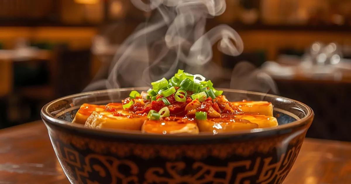
At 263 Serangoon Central Drive, the sesame chicken claypot ($6.30/$8.30) lands on your table still bubbling, the sesame oil smell hitting you before the spoon does. The meat is well-marinated, the broth rich without being heavy. If you need something lighter but still comforting, the sliced fish herbal soup ($7.30/$9.80) is a steady pick. This is the kind of food that makes a rainy Tuesday feel like you’ve given yourself a treat, without the need to dress up or queue forever.
If you enjoy digging into neighbourhood gems like this, our guide to Discover Finest Culinary Gems in Tanjong Pagar is worth a look.
Address: 263 Serangoon Central Drive, #01-43, Singapore 550263
Phone: +65 9001 0814
Hours: Daily 11am–9:45pm
Price signal: Dishes from $6.30
Website: lauwangclaypot.com
That rainy afternoon? This is where you go. The sesame chicken claypot lands bubbling, the aroma cutting through the damp, and for five minutes nobody talks — just spoons clinking. It’s the meal that turns a washed-out day into the one you remember warmly. Follow it with the herbal fish soup if you’re building a longer comfort-food route.
Katong lets you taste Singapore’s living recipes through dishes that tell a story.
Srisun Express

56 Serangoon Garden Way keeps its lights on 24 hours, which is exactly what you want when the 2am hunger hits. Srisun Express mashes up Indian, Western and Mexican influences on one long menu. The Maggi Goreng ($5.50) is a dependable order, and the Tissue Prata Butterscotch ($7) covers the sweet tooth. Portions are generous, so even the Tikka Tacos ($10) and Masala Fries ($4.40) will put a dent in a serious appetite. There’s no wrong time to show up, but after midnight the place has a proper supper-club energy.
Nothing on this page is a paid placement. If you know a place that should be here, let us know before the next update.
Address: 56 Serangoon Garden Way, Singapore 555952
Phone: +65 6282 2325
Hours: Daily 24 hours
Price signal: Prata from $1.40, mains $4.40–$10, huge drinks $13–$22
Website: srisunexpress.com.sg
After midnight, the group chat buzzes — where to eat? Point them here, where the lights never go out. The Tissue Prata Butterscotch becomes the photo everyone posts, but it’s the generous Maggi Goreng that anchors the table. This is the pit stop that turns a late hangout into your weekend’s core memory.
Chong Qing Grilled Fish

Chong Qing Grilled Fish on Maju Avenue runs on mala heat and late hours. Die die must try the Sea Bass ($36++/$43++) in Spicy Fragrant sauce if your mouth can handle it. The fish arrives flaking off the bone, soaked in chilli and Sichuan pepper, and if you need more fire there’s Hot-Plate Mutton with Cumin ($16++) on the side. Open until 2am on weekends, it’s the spot where you bring the kakis who never say no to sweat-inducing, share-everything dinners.
For more fiery food trails, we’ve also compiled Discover Finest Culinary Gems around Bukit Timah.
Address: 2 Maju Avenue, Singapore 556680
Phone: +65 6702 6680
Hours: Mon–Fri 4pm–2am, Sat–Sun & PH 12pm–2am
Price signal: Fish $36++ to $46++; sides around $16++
Web: Facebook page
Flaking and fiery, the sea bass in spicy fragrant sauce is one for kakis who measure a meal in sweat. The table goes quiet except for sharp inhales and ‘wah, shiok’ under breaths. Weekend nights here run past midnight, so plan this as the late climax of your spice trail. It’s the story you’ll tell with a cold drink in hand.
Shamiana Restaurant

Shamiana sits at 24 Maju Avenue, Serangoon Garden, doing North Indian food that feels made with patience. The butter chicken and garlic naan are what most tables start with, and the curries show a depth of spice that comes from cooking them in dedicated woks. It’s the kind of place you pick when you want a sit-down dinner that’s a notch above casual – good for parents, date night, or when you just want to be served something hot without shouting over a hawker-centre crowd.
Address: 24 Maju Avenue, Serangoon Garden, Singapore 556696
Phone: +65 6283 9685 (WhatsApp available)
Email: [email protected]
Hours: Daily 11am–10:30pm
Price signal: Moderate to higher-end Indian dining
Website: shamiana.com.sg
When the plan calls for a proper sit-down — parents in town, anniversary dinner — this is the stop that upgrades the evening. The butter chicken carries that slow-cooked depth, and the garlic naan disappears fast. It’s the kind of meal where conversation flows easily, and later someone says, ‘That was solid.’ Plan it mid-evening for a relaxed pace.
Greenland Vegetarian Restaurant

Greenland Vegetarian runs two shop units at 789 and 791 Upper Serangoon Road, dishing out plant-based Chinese and Oriental fried rice that doesn’t leave you hungry an hour later. The Petai Fried Rice carries enough wok hei to satisfy the non-vegetarians at the table, and the Gong Bao G Nugget Rice keeps the spice level honest. Portions are large, the seasoning is balanced rather than salty, and the service is quick – useful when you’ve got a mixed group and you just want everyone fed without a fuss.
Also worth a look: our round-up of Discover Finest Bishan Food if you’re exploring nearby.
Address: 789 & 791 Upper Serangoon Road, Singapore 534659
Phone: +65 6385 7477
Hours: Daily 11:30am–10pm
Price signal: Affordable – generous rice plates below $10
Website: greenland.zzv.com.sg
Bring everyone here, and watch sceptics go quiet after one bite of petai fried rice — a spot for the mixed-diet group. That honest wok hei fills the air the moment it lands, and the large plates mean nobody leaves hungry. Quick, unfussy service keeps your afternoon moving, so slot this in as a hearty lunch before your next stop.
Lao Zhong Zhong Eating House

A short walk from the Tai Thong Crescent shophouses, Lao Zhong Zhong has been doing Teochew-style ngoh hiang and bak chor mee since the 1950s, and the regulars don’t let them forget it. The ngoh hiang is rolled and fried by hand, arriving crisp outside, full-flavoured inside. The fried oyster omelette gets the balance right – eggy, starchy, with just enough crisp edge – and the bak chor mee delivers that QQ noodle bounce with a sauce worth mopping up. Closed on Mondays, so plan around that. No website booking, no fuss – just turn up and eat.
Address: 29 Tai Thong Crescent, Singapore 347858
Hours: Tue–Sun 11am–11pm (closed Mon)
Price signal: Hawker-style pricing, most dishes under $10
Facebook: Lao Zhong Zhong Eating House
How to choose
Start with the occasion. If it’s a last-minute group feed where everyone wants something different, SimpleBurger Inc or Srisun Express give you variety without endless discussion. For a lingering dinner with family, Chong Qing Grilled Fish or Shamiana work better because they are built for sharing. If you’re eating alone and want something soulful under $10, Lau Wang and Lao Zhong Zhong deliver without the frills. Vegetarian or bringing a friend who is? Greenland Vegetarian will fill them up properly, not leave them picking at side salads.
Check the clock too. Late-night options shrink to Srisun Express (always open) and Chong Qing (till 2am). Most other spots close by 10pm or 11pm. Pricing in Serangoon spans from wallet-friendly claypot rice at $6.30 to $40+ grilled fish, so set a rough budget before you head out – it’s easy to find a satisfying meal at any level.
| Eatery | Must-Try Dish | Price Range | Best For |
|---|---|---|---|
| SimpleBurger Inc | Build-Your-Own Beef Burger | $9–$15+ | Casual, customised burgers |
| Lau Wang Claypot Delights | Sesame Chicken Claypot | $6.30–$11.50 | Hawker-style comfort food |
| Srisun Express | Maggi Goreng / Tissue Prata | $1.40–$10 (mains) | 24-hour supper, fusion bites |
| Chong Qing Grilled Fish | Grilled Sea Bass (Spicy Fragrant) | $36++ to $46++ (fish) | Mala feasts, late group dinners |
| Shamiana Restaurant | Butter Chicken with Garlic Naan | Moderate to higher | Sit-down North Indian meals |
| Greenland Vegetarian | Petai Fried Rice | Below $10 (rice plates) | Affordable plant-based meals |
| Lao Zhong Zhong Eating House | Ngoh Hiang | Under $10 | Old-school Teochew hawker fare |
Summary
Serangoon rewards anyone who turns up hungry. It stretches from a 24-hour prata counter at Srisun Express to a claypot of sesame chicken at Lau Wang, and the real gift is how many of these places sit inside everyday neighbourhoods rather than shiny malls. Pick a day, a budget, and the kind of table that sounds right – there is almost certainly a plate in Serangoon with your name on it.
Disclaimer: Details like opening hours and prices can change. Confirm directly with the business before making a special trip.
Read next
Frequently asked questions
The queue here moves fast, and it’s worth every minute for that hand-rolled ngoh hiang — crisp, savoury, unmistakably old-school. The oyster omelette arrives with just the right edge, and before you know it, you’re already planning the next trip. Make this the first morning stop, then let the rest of the day unfold with that satisfied feeling.
What types of food can I find in Serangoon?
The area covers burgers, claypot dishes, Indian-Muslim prata and tacos, Sichuan grilled fish, North Indian curries, vegetarian Chinese fried rice, and traditional Teochew hawker fare. Each listing focuses on a different cuisine, so you can find almost any everyday craving covered.
Are there vegetarian options in Serangoon?
Yes. Greenland Vegetarian Restaurant specialises in plant-based Oriental and Chinese mains like Petai Fried Rice and Gong Bao G Nugget Rice. Several other eateries also have vegetable-based sides or can be customised, though you should check with each kitchen directly if you need strict meat-free cooking.
Which Serangoon eateries are open late?
Srisun Express operates 24 hours daily, and Chong Qing Grilled Fish stays open until 2am on Fridays, Saturdays, and public holidays (4pm to 2am on weekdays). Most other spots close between 10pm and 11pm.
Is it easy to get a table at these places?
Many are casual, walk-in spots—especially Srisun Express, Lau Wang, and Greenland Vegetarian. Chong Qing Grilled Fish and Shamiana can get busier during peak dinner hours on weekends, so going early or off-peak helps. None require formal reservations, but it’s wise to call ahead for larger groups.
What is the typical price for a meal in Serangoon?
Hawker-style dishes and vegetarian rice plates sit around $5 to $11.50. A customised burger with sides runs $9 to $15. Grilled fish feasts are $36++ to $46++, and North Indian dining at Shamiana falls in a moderate to slightly higher bracket.
Do these restaurants offer delivery?
Several are available on third-party delivery platforms, and some take direct phone or WhatsApp orders. For the most up-to-date delivery options, check the individual eateries’ websites or social media pages.